

Severe risk on Saturday
March 6, 2026 · by tvnews2(42 days ago)
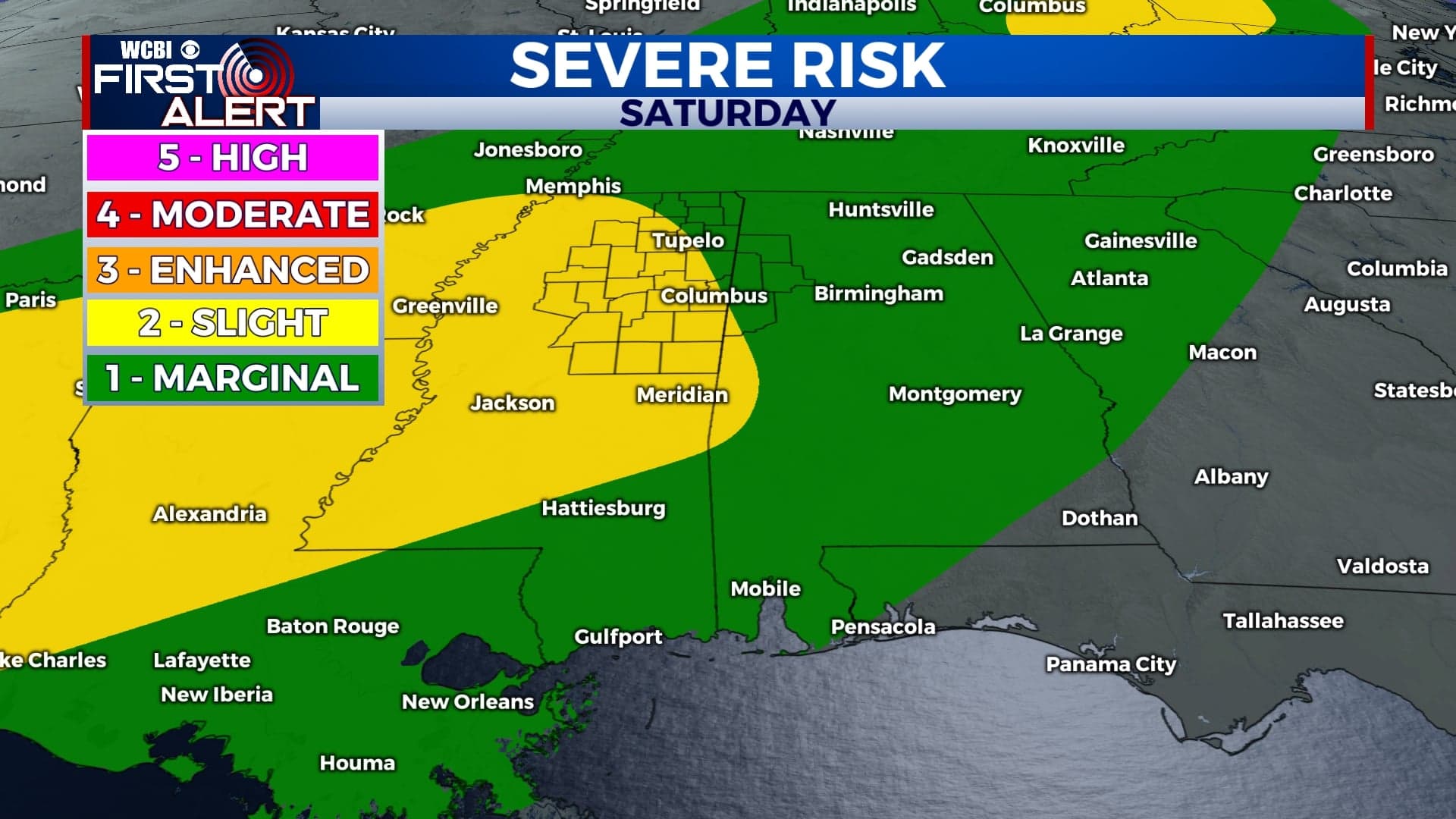
COLUMBUS, Mississippi (WCBI) – Severe potential heading our way for the weekend. Rain chances will continue into next week.
FRIDAY NIGHT: Mild and a little muggy. Heavy clouds will hold overnight. There may be a few more chances for some in our corner to see rain tonight. Low temperatures will drop into the middle 60s.
SATURDAY: Most of the morning will be dry. It is going to be a cloudy start to the day. Afternoon highs are going to be warm again, aiding in the environment set-up ahead of storms. Showers and storms are likely to move across our corner from 12p-8p. Storms could become strong to severe. There is a Level 2 – Slight Risk for severe potential. All modes will be possible – gusty wind, hail, and potentially tornadoes. Have multiple ways to receive watches and warnings! Know what county you live in and where it is located on a map.

SUNDAY: Rain will continue into Sunday morning. Isolated chances will linger throughout the rest of the day, with heavy clouds. Temperatures will be in the low to middle 70s. Temperatures will be in the lower 60s overnight.
NEXT WEEK: A chance for showers and storms will continue most days next week. Monday and Wednesday currently have the highest potential. Afternoon highs will gradually work back into the lower 80s by mid-week, taking a drop to the upper 60s/lower 70s for the end of the week.
More Stories

Featured
City of Columbus discusses trash/furniture pickup policy during work session
37 days ago

Local News
FTC to refund more than $47 million to consumers allegedly deceived by Invitation Homes
37 days ago

Featured
Homeless population in Tupelo has risen slightly since last year
37 days ago

Local News
Sharks are taking a bigger bite of fishermen’s catch in Hawaii: “Paying the tax man”
37 days ago